
Nantucket Harborshed and Groundwater Mapping
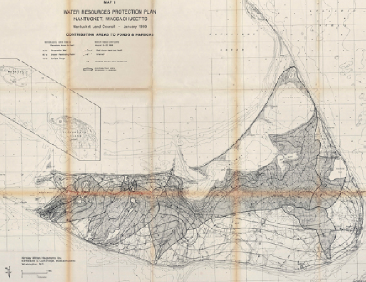
Nantucket Harbor watershed mapping was last done in 1990 - a lot has changed since then
This will help identify watershed boundaries, groundwater nutrient sources, and groundwater flow paths into Nantucket Harbor
The information collected will allow us to create individual groundwater management strategies that are specific to each neighborhood
TON is currently in the process of hiring the specialized contractor to begin this study
